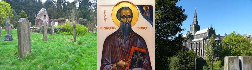
Introduction
The following historical ‘snapshots’ are intended only to give the walker some brief details of the various
places of interest that he will pass as he proceeds along the Kentigern way. They are organised south to
north in the direction of the walk and in the order he will encounter them. It is hoped that they will
serve to add interest to the route and offer a glimpse of the rich historical context of the landscape he
is traversing.
The information contained in these short descriptions has been gleaned from many sources – too many to
list individually here. The author wishes to pay due tribute to the work of those others that he has made
use of while admitting full culpability for any errors or misinterpretations that have occurred.
Section 1
-
Annan Church NY 195 664
Key historical events
- AD 573 – St Mungo passes through Annandale
- AD 686 – Abbot Adamnan of Iona at Annan Waterfoot
- AD 1148 – St Malachi, Bishop of Clairvaux, visits Bruce at Annan.
- AD 1171 – Church of Annan built by Robert Bruce near the site of the Town Hall.
- AD 1223 – Church transferred to See of Glasgow.
- AD 1538 – In recognition of the town's loyalty a Charter is granted to Annan by King James V.
- AD 1560 – The reformation. The Scottish church breaks its ties with Rome.
- AD 1609 – Church built behind site of Town Hall
- AD 1612 – The town's Royal Burgh status is reaffirmed by King James VI
- AD 1789 – The present church is built
For access to their website click here.
-
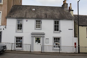
Annan Museum NY 195 664
The family friendly museum houses a permanent exhibition on the history of Annan and the surrounding
area.
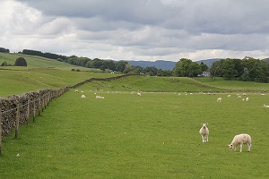
The fords or “waths” which cross the eastern Solway Firth were the routes taken by invading armies for more than two thousand years. Their principal routes were then up Annandale and Eskdale.
The Roman Empire was not confined by Hadrian's Wall. The Romans invaded what is now Scotland many times and established large camps and fortifications in Annandale when securing their roads for their campaigns further north.
In the 13th and 14th centuries the Bruce family, who were the Lords of Annandale, took a very active role in the struggle for Scottish independence and the lands on both sides of the border suffered the consequences of outright war between England and Scotland.
Even in the times when both nations were at peace the valleys were subjected to raid and counter raid for more than 200 years as the powerful families on both sides of the border made their living as "reivers". The "reivers" were fast, well-armed horsemen with no allegiance to either side who rode by night to steal cattle and any moveable goods. The many fortified tower houses and other structures are a grim reminder of the turbulent past.
A fascinating journey through time takes visitors from the prehistoric period up to the era of nuclear fission. Displays include costume, First World War memorabilia, town regalia and a remarkable collection of paintings depicting Annan and the Solway shore. Exhibits include a 4000 year old Bronze Age burial urn, mummified baby crocodiles and a 110 year old piece of chocolate.
For access to their website click here.
-
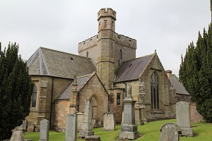
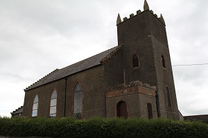 St Brydeskirk NY 182 704
St. Bride (or Bryde or Brigid) probably lived from around the second half of the 4th century. She was an Irish
nun and abbess who became one of the patron saints of Ireland and had many Scottish Churches dedicated to her. She was also
the patron saint of the powerful Douglas family.
She is widely venerated in Ireland and her cult was spread to Scotland and to Europe more widely by Irish
missionaries in the following centuries. Many pre-reformation Scottish churches were dedicated to St. Bride. One (admittedly
controversial) theory is that St. Bride was given the name of the powerful pagan goddess Brigid; the appearance of a Christian
Saint called Brigid being an invention of her early biographers seeking to find a way to convert pagans to the Christian faith.
Brydekirk, originally known as Bridechapel sourced its water from the already existing St Brydes Well, the name
suggesting connections with the saint and therefore possibly having holy or restorative properties. The spring is still there but difficult to locate. The present village sprung up around the small chapel dedicated to Saint Bryde. In 1983 excavations found coins dating back to the 14th century are now in the Dumfries Museum.
The present attractive church occupies a commanding position at the top of the main street from which vantage
point the minister can keep a close eye on the comings and goings of his parishioners!
-
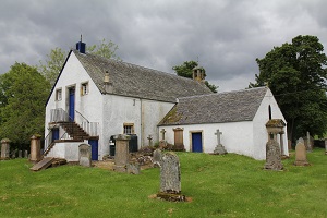
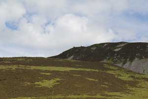
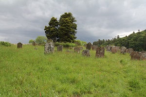 St Kentigern's Graveyard NY 171 728
Hoddom is the site of a major episcopal seat established by Kentigern which, it is recorded, rivalled Lindisfarne
in importance. There are various accounts of how Kentigern came to be there. According to Jocelyn of Furness he was gifted
the land by Owain mab Urien King of Rhegged/Cumbria. As you stand in the little graveyard dedicated to Kentigern, the site
can be seen to have been well chosen, situated near the river in a fertile valley capable of supporting a large community
and strategically located for forays south across the Solway into Cumbria and Wales.
Nothing remains of the original buildings which would probably have been constructed of earthen works and wood.
In the corner of the graveyard there is a little mound which may have been the site of the original building. According to
the foundation legend Kentigern followed an angelic vision and set out with 665 disciples to arrive at Hoddom where he is
greeted by a multitude of people. "Drawing a cross and invoking the Holy Trinity, Kentigern orders anyone against the
word of God to depart. This results in a vast multitude of skeleton-like creatures, horrible in form and aspect"
departing from the assemblage and fleeing from sight. As Kentigern preaches faith in Jesus Christ the flat plain of
"Hodelm" rises into the little hill which remains to this day. Kentigern spent many years directing his evangelising
activities from Hoddom until he was eventually recalled to Glasgow where he presided over an extensive See until his death.
There is archaeological evidence of a later Northumbrian monastery based around St Kentigern's church at
Hoddom founded in the 8th century.
-
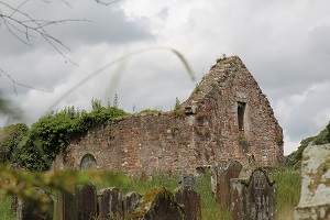
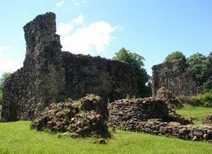
Hoddom NY 163 726
This was the site of the 12th or 13th century kirk, which became ruinous after the union of Hoddom with Luce and
Ecclefechan. In regard to the early importance of this church archaeological evidence would indicate the existence
of an important ecclesiastical centre at this site in the 8th and subsequent centuries. This includes an early nave
built of re-used Roman material (clearly from Birrens), with megalithic quoins which was excavated about 1915. The
construction is like that of the Anglian churches at Jarrow and Escomb, both dating from about AD 700. The finds of
Early Christian monuments including two fine 8th century crosses and part of a 10th century staff or crozier shrine,
are too numerous to be accounted for in any other way.
-
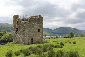
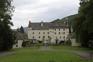
Hoddom Castle NY 155 728
The Bruce family were granted the lordship of Annandale in the 12th century and they divided the area into
baronies, one of which was the barony of Hoddom (or Hodelm) the seat of which is thought to have been at Old
Hoddom Castle (now Hallguards. In 1312 the lordship was granted to Thomas Randolph, 1st Earl of Moray, by
Robert the Bruce. The present Hoddom Castle is a 16th century L-plan tower house which may incorporate
earlier work, and is reputed to be the largest castle built in the Borders in the 16th century. The lordship
changed hands many times and eventually passed to Sir John Maxwell who was a loyal supporter of Mary Queen
of Scots and fought for her at the Battle of Langside in May 1568. The following month Regent Moray besieged
Hoddom and the castle surrendered after only one day. Moray gave the castle to Douglas of Drumlanrig and
it was used as the headquarters for the English-occupied West March. In 1569 the castle was recaptured by
forces loyal to Mary but was then blown up in 1570 when attacked by an English force.
-
 St Mungo's Church NY 128 757
The former parish church of St Mungo comprises the remains of a medieval and later church and graveyard, It
survives as a ruined building with associated memorials and gravemarkers within a stone boundary wall. The church was first
recorded in around 1120 as "Abermelc", one of the possessions of the see of Glasgow.
Only the chancel (E gable), S wall and part of the N of the church are upstanding, in places almost to wallhead
height. Although the church was redeveloped in the 1740s and 1750s, a lower string course survives along the E gable and
this is likely to represent the surviving medieval remains of the building, as are portions of the N and S walls. In around
1880 the Jardine family (converted the church's remains into a family burial plot. The Jardine headstones are mainly
located into the E and S walls of the church.
It provides a good example of a documented later medieval church and graveyard, where the church was later
remodelled and adapted in the 19th century for use as a private family burial plot. The standing remains of the church
display a number of building phases and these indicate a long period of use and re-use.
This church was part of a network of parish churches covering the country and served as a central place for
worship, prayer, baptism and burial. Part of the see of Glasgow, it was therefore part of the wider organisation of
religion in medieval Scotland. It is one of 39 churches known to have held parochial status in eastern Dumfriesshire
before the Reformation and one of only a few local examples that substantially survive.
-
 Lochmaben Castle NY 082 823
Lochmaben Castle is a ruined castle in the town of Lochmaben, the feudal Lordship of Annandale,
It was built by Edward I in the 13th and 14th centuries, and later rebuilt during the reign of James IV of
Scotland. An earlier motte–and–bailey castle was built south of the current castle in c. 1160 by the Bruce
family, Lords of Annandale.
King Edward replaced the motte–and–bailey castle with a much sturdier structure at the south end of
Castle Loch around 1300 and its remains still show the massive strength of its defences. Archibald Douglas,
Lord of Galloway took Lochmaben Castle from the English in 1384, after a siege of nine days and "razed it
to the ground".
Lochmaben Castle continued to have a turbulent history until sometime after the early 17th century by
which time it had seen its last siege and was gradually abandoned. It is now maintained by Historic
Environment Scotland and is open to visitors all year round.
-
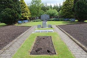 Lockerbie Memorial NY 136 815
At three minutes past seven on the evening of Wednesday 21 December 1988 a bomb exploded on board Pan Am Flight 103, a Boeing 747 en route from London to New York. The aircraft broke up almost immediately, and wreckage came to earth over a wide area. The largest parts of the aircraft landed on the Scottish town of Lockerbie. All 243 passengers and 16 crew on board Flight 103 were killed, as were 11 people on the ground in Lockerbie.
The Lockerbie Bombing or the Lockerbie Air Disaster remains the deadliest aviation incident, and the deadliest act of terrorism, ever to take place in the United Kingdom. Those killed included nationals of 21 different countries in five different continents, and the victims ranged in age from 2 months to 82 years old.
The main focus for remembrance in Scotland lies just under a mile west of Lockerbie along the A709 Lochmaben road. Dryfesdale Cemetery extends back to the north of the road, and here you find the Garden of Remembrance and Lockerbie Air Disaster Memorial. The garden lies towards the far end of the cemetery and is a beautiful and tranquil place in which to think about those who lost their lives in the skies above the town and on the ground.
The garden leads you through beds of flowers and past individual memorials to the Lockerbie Air Disaster Memorial. This is constructed of grey granite and is arranged in the form of a triptych. It is imposing in its sheer size, but sobering too, when you realise that the size of the memorial is simply a function of the number of names it carries.
Near the entrance to the Dryfesdale Cemetery is the Dryfesdale Lodge Visitors' Centre. This was originally the
cemetery caretaker's cottage, but since 2003 has served as a centre for the local community, for visitors to Lockerbie and,
in particular for visitors to the Garden of Remembrance and Lockerbie Air Disaster Memorial. A number of rooms have been
converted to accommodate information about the area, and about the air disaster. The visitors' centre is also the home
of the Book of Remembrance.
Section 2
-
 The Battle of Dryfe Sands NY 121 836
For over half of the 16th century the Maxwell and the Johnstone families had vied for supremacy of the
Scottish West March. Lord Maxwell, Earl of Morton decided once and for all to settle the matter and destroy his rival.
On the 6th December 1953 he invaded with an army of 2000 men with a view to destroying the Johnstone family seat in
Annandale. However Sir James Johnstone received intelligence of the impending attack and called for help from sympathetic
families but in the event could only muster about 1000 men.
As the Maxwell forces approached Lockerbie their vanguard was engaged by a small detachment of Johnstone's
who attacked then withdrew towards Lockerbie. The Maxwell forces pursued them but were caught off guard by the main body
of Johnstone's lying in wait for them. The Maxwell forces were routed and withdrew in total disorder pursued by the
Johnstone forces. A stand was finally made at the Dryfe River and in the ensuing encounter the Maxwell forces were
slaughtered, losing a large number of their men. Lord Maxwell gave himself up and begged for mercy but it is reported
that his outstretched hand was cut off and he was slain. Some years later Lord Maxwell's son attended a meeting of
reconciliation with Sir James Johnstone but drew a pistol, shot him in the back and fled to France. He was subsequently
apprehended and beheaded.
-
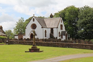 Applegarthtown NY 105 843
This unusual name derives from the Norse for "Apple-yard" or orchard indicating the fertile nature of
the place. A Roman road is thought to have run through Applegarth, in which there are no fewer than 3 camps and 14
hill-forts. Two of the latter are to be found on Dinwoodie Hill, where is also the graveyard of a chapel, said to have
belonged to the Knights Templars. At the SW corner of the parish stood its old church, where, on 7 July 1300, Edward I,
then marching to besiege Caerlaverock, offered oblation at the altars of the Saints Nicholas and Thomas a Becket. The
attractive present church (built 1760; repaired 1822) stands near where the old one stood.
Section 3
-
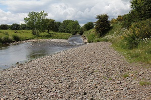
 Roman Road at Beattock NT 0825 0365
The Romans invaded Scotland three times. The first invasion was by Agricola in 78 AD . The majority of
roads appear to date from this first invasion. The principal road (Dere Street) took a route to the east through
the Cheviots to the Forth near Edinburgh. A secondary route (Watling Street) ran from Carlisle north to Crawford.
The Roman Army were quick to recognise the value of Annandale as a route into the Midland Valley of
Scotland, building a road from Carlisle to the Forth and Clyde. They were interested in the Southern Uplands as
an area of potential conquest, later briefly as an occupied province, but for most of the time as an area where
it could meet and defeat threats from the Caledonian tribes.
The gravel terraces of the Evan Water near Beattock were well-drained and easily dug, so preserve the
remains of up to six marching-camps and semi-permanent fortifications. The area was important enough to have had
several fortlets with maybe one or two centuries (80 -160 auxiliary troops) in each - enough to patrol and repair
the road and to keep local tribes from casual raiding. The full detail of Roman occupation is still sketchy, but
the Roman Army certainly marched near Moffat.
The road ran north from Stanwix near Carlisle and met another from just north of Dumfries and
Lochmaben, then continued north up Annandale. Substantial portions of the road survive north and south of
Johnstonebridge, before the route crosses the Annan somewhere between Dalmakethar and Tassieholm. The road
contiuess north to a group of marching-camps and a fortlet at Milton (Tassieholm), crossing the Annan again
(maybe at Holms Bridge) before crossing the Beattock gravels just east of Lochhouse Tower. North of there
the Roman road crosses the southern approach into Moffat and heads up Chapel Hill across the Moffat Golf Course.
-
 Moffat Museum NT 084 053
Moffat Museum provides a fascinating insight into the town's history - from early Roman times, the turbulent times of the Border Reivers, the heyday of its coaching era, to the discovery of the Well and Moffat's popularity as a spa town. The new and expanded Museum opened in 2013 and now features stunning artefacts on loan from the Museum of Scotland.
The Museum is on two floors. The lower floor illustrates Moffat's history through several key exhibits. Included is a Neolithic bow found in the hills above Moffat and a Roman brooch found on Ericstane Brae. The upper floor has eight displays covering different aspects of Moffat's history, such as education, agriculture, the history of the Spa and famous people associated with Moffat. An outside yard hosts a display of agricultural tools and exhibits relevant to Moffat's railway history.
The museum now includes a new space dedicated to the Merlin Trail, of which Moffat is the hub.
The Moffat History Trail is also featured.
A seven minute video tells the story of the town and regularly changing exhibitions mean that there is always something new to see.
-
Moffat Church NT 085 051
St Andrew's Parish Church, Moffat, with its huge red stone tower, dominates the approach to the town along the A701 from the M74 and the south. Even if it had been built in a more retiring position it would be difficult to overlook the largest parish church in South West Scotland.
The first recorded Parish Church, in what was known as the Auldton of Moffat, was already built by 1177, when it is recorded as being transferred to the Bishop of Glasgow. In the 1600s it was used as a prison for Covenanters en route to their execution.
In 1790 the prime site opposite the Black Bull Hotel was given by the Earl of Hopetoun for the building of a new church. This was duly built, with seats for 1,000 people. The church was topped off with a spire, which carried the Earl of Hopetoun's crest of a flying spur. As a result the church became known to townsfolk as the Flying Spur Kirk.
The Flying Spur Kirk did not last for long, being replaced by a new parish church on a site immediately to its south. St Andrew's Parish Church, Moffat, opened its doors for worship for the first time on 23 September 1887, just 97 years after the Kirk it replaced.
-
Hartfell Spa Chalybeate Spring NT 097 116
A chalybeate spring is found on the slopes of Hartfell above Moffat. The word "chalybeate" is derived from the
Latin word for steel, "chalybs" and refers to the high mineral content of the waters. Chalybeate springs are found extensively throughout Britain (and the world and were prized for their health giving properties.
Perhaps of more direct interest is the connection with Merlyn whose story appears interwoven with that of Kentigern. In the historical annals Myrddin/Merlyn is described as the bard to Gwenddoleu, a king in the Brythonic speaking lands of Southern Scotland and North West England. At the battle of Arfderydd or Arthuret in 573 AD Gwenddolue is killed. Appalled by the carnage of the, battle Merlin seeks refuge in the forests of Caledon in Southern Scotland and takes up abode in a cave on Hartfell (located near the spring). It is reputed that Kentigern met Merlyn there and debated with him eventually converting him to Christianity. However this is more likely to be based on Christian propaganda. Nevertheless there is strong evidence that Merlyn did coexist with Kentigern and that they were powerful figures on opposite sides of a Christian/Druidic conflict. They would have been aware of each other and conscious of the threat that each posed in the struggle for religious supremacy.
We shall come across references to Merlin again in our journey northwards.
Section 4
-
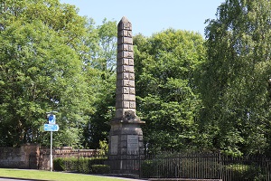
 Monument to Ettrick Shepherd NT 238 206 and NT264 144
James Hogg was born in 1770 at Ettrick Hall, at the top of the Ettrick Valley. The second of four sons of an impoverished farmer, he left school after six months' formal education. Aged seven, he began to work on the lowest rung of the farming ladder - as a cowherd.
But he had learned, at his mother's knee, the great oral tradition of ballads and folklore of the Borders. James Hogg taught himself to read and write, and to play the fiddle, and entered the skilled profession of shepherding. He began making songs and verses for local gatherings. The other young people of the valleys called him "Jamie the Poeter". His career had begun.
At the turn of the eighteenth century, Hogg was working as a shepherd on the farm on Blackhouse in Yarrow for the Laidlaw family, who opened their hearts and library to the young shepherd poet. It was at this time that Walter Scott, the newly appointed sheriff of Selkirk, was roaming the Border Valleys in pursuit of the disappearing ballads of the Borders. Through the Laidlaws, he met James Hogg and his mother who had a rich store of the ballads. The two young men were almost exact contemporaries. They began a friendship that was to last, despite many tensions, throughout their lives.
The work for which James Hogg is best known is the "Confessions of a Justified Sinner".
Section 5
-
 Dryhope Tower NT 2715 247
Dryhope Tower was originally a four story building with the first two stories of vaulted construction. The tower
rests within the remains of a strong house or "barmkin" which would also have contained other buildings.
The tower was likely to have been built according to a Statute of Parliament in 1535 that required large
landowners in the Borderlands to build strong houses for the defence of themselves, their tenants and goods in troublesome
times.
The tower belonged to the Scotts of Dryhope and a daughter of the house, Mary Scott, "The flower of Dryhope"
, was an ancestor of Sir Walter Scott. The tower passed to Wat Scott, a notorious border riever, through marriage but In
1592 Wat fell out of favour with James VI because of his association with the Earl of Bothwell. The king raised an army
and marched against the Scotts. As a result the tower was slighted. It seems to have been rebuilt later but subsequently
fell into decay and was acquired by the Dukes of Buccleuch. It has recently been stabilised and partially restored.
-
 Traquair Kirk NT 332 347
Traquair is said to mean "hamlet on the Quair Water", a river which runs northwards from Slake Law to drain into the River Tweed north of Traquair. The village was once surrounded by the great Ettrick Forest, the remnants of which are still strongly in evidence
In early times the village bore the name Kirkbryde or Strathquair, the Kirkbryde coming from the local church which was dedicated to St Bride or Bridget. As early as the 12th century, Traquair was important enough to be raised to the status of a sheriffdom.[2]
Although the present church, an 18th century Grade B listed building, is not on the original site of the older buildings, it still marks an area that has seen over 900 years of continuous Christian worship. A building was first written about in the 12th century and was named for St. Bride. At the time of the Reformation it was renamed Traquair Kirk and regularly moved between Presbyterian and Episcopal forms of worship and governance and finally in 1690 the Church of Scotland became Presbyterian.
-
 Traquair House NT 330 354
The name Traquair comes from tret or tre a word of Celtic origin meaning a dwelling place or hamlet, and from quair meaning a stream with a winding course. The Quair burn joins the River Tweed a few hundred yards from the rear of the house.
It is not known when the exact foundations of the house were laid but a substantial structure must have existed by
1107 when Alexander 1 of Scotland signed a royal charter at Traquair. At this time the castle was used as a hunting lodge
for royalty and also as a base where they could administer justice, issue laws and hold courts. At Traquair, many charters
still exist. One, signed in 1175 authorised William the Lion to found a Bishop's Burgh with a right to hold a market on
Thursday. This small hamlet was later to become the City of Glasgow.
During this period Traquair was nestled in the middle of the vast Ettrick Forest and provided a superb venue for royal hunting parties who came to hunt wild cat, wolves, deer, wild boar and bears who roamed the forest
After the death of Alexander III in 1286 the peaceful life of the Borders was shattered by the Wars of Independence. Traquair became one of the many fortified towers or peles that were built along the banks of the Tweed. When the alarm was raised they could communicate to each other by lighting a beacon at the top of the tower and alert the neighbours of an English invasion. Traquair was briefly occupied by English troops but returned to the Crown with the accession of Robert the Bruce in 1306.
More peaceful times eventually returned to Traquair in the 15th century and when James III succeeded in 1460
he gave Traquair to his current favourite Robert Lord Boyd, but when the gift was not appreciated he gave the castle to his
favourite court musician, William Rogers. However, he held Traquair for only nine years when he was persuaded to sell it
to the Earl of Buchan for the paltry sum of 70 Scots merks (just over £3.00).
The Earl of Buchan, a half uncle to the king then gave Traquair to his second son James Stewart who became the first Laird of Traquair in 1491. Since this date the house has remained in the same family.
Section 6
-
Drove Road Peebles NT 268 382
The droving of livestock in Scotland has gone on from earliest times but the Act of Union in 1707 greatly facilitated the trade between Scotland and England. The beef from Scottish hill fed cattle was greatly prized and was in high demand to feed the expanding empire. The droving trade in Scotland reached its peak in the 18th Century. Cattle were collected from all over the Highlands and North East and brought down to the great fairs in Crieff and later Falkirk. At its height 150,000 beasts were traded each year at the Falkirk Tryst.
Cattle destined for the English markets were brought south from Falkirk through the Cauldstane Slap pass in the
Pentlands, through Peebles and over Kirkhopelaw to Dryhope at the east end of St Mary's Loch. Beyond, the drovers had to take their herds through the lawless Borderlands where they were constantly under threat of attack by the Reivers. It was a rough and dangerous trade and the drovers had to be well-armed and capable of defending themselves.
As you approach Peebles from the south on the Cross Borders Drove Road the drystone dykes on either side of the path to keep the herds of cattle from straying are clearly visible.
-
Peebles Museum/John Buchan NT 253 404
Tweeddale Museum and Gallery is housed in an historic building going back to the 16th century and is
home to a lively programme of exhibitions and events all-year-round. The Chambers Institution, as it is now
known, was gifted to the town in 1859 by William Chambers – one of the founders of the famous publishing house. Scottish philanthropist, Andrew Carnegie, also made his mark on the building; significantly funding the library on the lower levels.
This striking building now hosts a vibrant museum and gallery, with permanent displays and changing exhibitions showcasing the best of the Borders, ranging from visual arts through textiles to historical interest. The Chambers Room houses the extraordinary plasterwork friezes commissioned by William Chambers, including a 16-metre reproduction of portions of the Elgin Marbles. Other pieces look at the history of Peebles and the surrounding area, which played a key role in the woollen industry of the Borders in the 19th and 20th centuries.
-
 Peebles Churches NT 253 404 & NT 250 404
Though the present church was opened in 1887, the Parish Church of Peebles has, through the centuries, occupied at least
four previous buildings. The first, dedicated to St. Mungo (Kenttigern), was built 1500 years ago and had Kirk Lands in
excess of 100 acres. It was first written about in 1116 when it was listed in the Inquest of the Elders of Cumbria. It
was built within what is now a cemetery but no trace remains. The second Church, on the same site as the first, was
dedicated to St.Andrew by Bishop Joceline of Glasgow in 1195 during the reign of William the Lyon. It was burned by
the English in 1549 at the same time as the destruction of the Border Abbeys. Only the tower now remains, along with a
fragment of wall. At the Reformation in 1560 the Parish Church moved to an existing church building, known today as
the Cross Kirk. The Church of the Holy Cross had been founded by Alexander III in 1261. John of Fordun, writing
in 1385,
tells of its origin: “On the ninth day of May, 1261, in the thirteenth year of King Alexander, a stately
and venerable
cross was found at Peebles . . . It is believed that it was hidden by some of the faithful about the year of our Lord 296
while Maximian's persecution was raging throughout the land.”
After the cross was discovered, Peebles became a place of pilgrimage and the King ordered the erection
of a Church
on the spot. In 1473, James III founded a monastery round it – the Monastery of the Order of Trinity Friars. It was
this Church that became the Parish Church at the Reformation in 1560 and remained so until 1783, when its ruinous
condition made a move essential. The Parish Church then moved to its present site on Castle Hill and was opened in
1784 where it remained until its closure and demolition in 1885.The present Church on the same site was dedicated on
29th March, 1887.
-
Neidpath Castle NT 237 404
Nestling on the side of steep gorge overlooking a bend of the River Tweed, Neidpath Castle is an altered
L-plan tower with rounded corners. The tower dates from the 14th century, but was substantially remodelled in the
16th century and later.
An earlier castle here belonged to Sir Simon Fraser. He defeated the English at Roslin in 1303, but was later
captured and executed by the English by being hanged, drawn and quartered. The property passed by marriage to the
Hays in 1312, who built the existing castle. Mary, Queen of Scots, stayed at Neidpath in 1563, as did her son
James VI in 1587.
The Hays were Royalists, and in 1650 Neidpath held out against Cromwell's army longer than any other stronghold
south of the Forth. Cannon damaged the castle, and the defenders were eventually forced to surrender.
Neidpath is reputedly haunted by the ghost of a young lass, the ‘Maid of Neidpath’, who was written about by
Sir Walter Scott.
Section 7
-
Cademuir Hill Fort
The hills of Cademuir form a natural stronghold, bounded by the Manor Water and the Tweed and dominating the through route from the Tweed to the Clyde valleys
Two Iron Age fortified settlements lie on the ridge. Cademuir I stands on the summit with good natural protection on all but the slightly less precipitous south-west side. There are traces of at least 35 timber-framed houses within the fort which suggests a site of some significance. It was, in fact, a small town but it was probably abandoned c AD 80 after the arrival of the Romans.
The second, considerably smaller fort, occupies the lower western summit of the ridge. Outside the massive stone ruins of its 6m thick enclosing wall, stand subsidiary enclosures. Its most interesting feature is undoubtedly the chevaux de frise protecting the north-east. More than 100 stones still stand over a distance of nearly 80m, set in the outer side of a small gully so that they would have been invisible until attackers had breasted the gully.
-
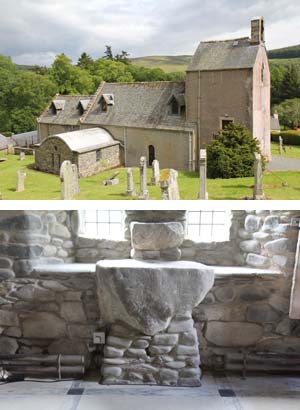 Stobo Kirk and Altar Stone NT 183 376 & NT 156 358
Stobo Kirk is one of the oldest standing churches in Scotland and offers a fascinating history combined with a truly beautiful interior.
Much of the church you see today at Stobo can be dated back to around 1120, though as the tower and nave are on slightly different alignments, they may have been built in different phases. The story of the church actually goes back much further, to the late 500s. The first church is said to have been founded here by St Kentigern, possibly during his tenure as Archbishop of Strathclyde from 585. Kentigern was known to have used Stobo as a place of retreat and part of a very ancient altar stone can be seen in the kirk. A second part of the altar stone has been found a little further down the road towards Drumelzier.
The most compelling legend from this era is that Kentigern met Merlin here and converted him to Christianity and
baptised him at a spot near Stobo, although another (perhaps more likely) version suggests that they debated then went
their separate ways. The story goes that Merlin, (one of two historical figures who were later combined to form the Merlin
in the Arthurian legend), had been living in the forests that covered the area since the defeat of the army of Gwenddoleu
by the King of Strathclyde in 573. This event is depicted in a stained glass window in the church. Another version has the
encounter between the two men taking place at Merlin's cave on Hartfell further to the south. It is clear from the
annals that the two men were contemporary and were leading political figures in the struggle between a strong Christian
insurgency and an existing Druidic orthodoxy.
-
 Drumelzier and Merlin's Grave NT 135 342
According to a local account it is here in Drumelzier, that Merlin, was imprisoned inside a riverbank tree by the enchantress Morgan le Fay. This may be a little fanciful.
Another account has it that Merlin was baptised and thus converted to Christianity by Saint Kentigern at the altar stone near the village and is said to have died through his 'three deaths' here. Legend has it that he prophesied his own death of falling, drowning and stabbing. It is said that he was chased off a cliff by shepherds where he tripped and fell, impaled himself on a fishing rod on the sea bed and died with his head under the water. Perhaps a more likely explanation is that he was caught up in some high level political skulduggery and was assassinated. His grave is considered to be located a little below the churchyard at the side of the Powsail Burn.
Another prophecy states:
"When Tweed and Powsail meet at Merlin's grave, Scotland and England shall one monarch have".
The very day that James VI of Scotland and I of England was crowned the prophecy was fulfilled, with the River Tweed bursting its banks and meeting with the Powsail Burn at Merlin's Grave, something it had not done before and has not done since.
Section 8
-
Biggar Museum NT 043 379
Biggar Museum Trust aims to collect, store, preserve and record Biggar and Upper Clydesdale's rich archaeological, social and historic heritage. The museum explores 14,000 years of rural and small town life in Upper Clydesdale. It focuses on the people who have lived and worked here from prehistoric times up to the mid-20th century.
The objects on display illuminate a small part of their ordinary and extraordinary lives. In addition to the museum galleries the building encompasses an area for temporary exhibitions and a retail outlet.
-
 Cadger's Brig
The pack horse bridge, located at the foot of the main street and by a ford on the Biggar burn is
known as the Cadgers Brig. Tradition has it that it was crossed by William Wallace disguised as a pedlar while
on a dangerous mission to spy on the English army camped near Biggar during the wars of independence. A bloody
battle ensued in which Wallace and his small army were routed by a superior English force. However this version
of the story is probably a confusion with the battle of Roslyn in 1303 when part of the Scottish Army did muster
at Biggar prior to the famous victory by Wallace at Rosslyn.
-
 Biggar Church NT 0415 376
There has been a place of worship on this site stretching back into the mists of time when early
Celtic Saints brought the Gospel into this part of Clydesdale. The first stone built church, dedicated to St
Nicholas, is recorded as being in existence as early as the 12th Century and, in the vestibule of this
building, hangs a list of ministers from Pastor Robert of Bigir in 1164, down to our most recent minister,
the Rev Michael (Mike) Fucella who joined our congregation in August 2013.
The church building you see today dates from 1545-6 when the church was rebuilt by Malcolm, Lord
Fleming, following an incident in Tweeddale when his father John, Lord Fleming of Boghall Castle in Biggar,
was slain by the Tweedie family while out hunting. The purpose of the new church was to offer prayers for
the "weal of the soul" of the founder, his wife, Janet Stewart (daughter of James IV), his parents, forebears
and successors in the years to come. To this end a provost, eight prebenderies, four singing boys and six
bedesmen were appointed to serve in the new church of St Mary's in Biggar. It was to be the last Collegiate
Foundation to be built in Scotland before the Reformation.
-
 Culter Motte and Baillie NT 019 364
A motte-and-bailey castle is a fortification with a wooden or stone keep situated on a raised earthwork called a motte, accompanied by an enclosed courtyard, or bailey, surrounded by a protective ditch and palisade. Relatively easy to build with unskilled, labour, but still militarily formidable, these castles were built across northern Europe from the 10th century onwards, spreading from Normandy and Anjou in France, into the Holy Roman Empire in the 11th century. The Normans introduced the design into England and Wales following their invasion in 1066. Motte-and-bailey castles were adopted in Scotland, Ireland and the Low Countries in the 12th and 13th centuries.
Coulter Motte was probably raised in the mid-twelth century to control a key area of movement between upper Tweedsdale and Clydesdale. Precisely who built the castle is not known for certain but it could have been a Flemish family, de Cuiter, one of a number of immigrant families encouraged by David I (1124-53) to settle in Scotland and help to bring the unruly country under his control. Other Flemish families settled in the area at this time and are remembered in the local place names such as Roberton, Laminton and Symington.
Little is known about the structure itself. The motte was presumably topped by a timber palisade and surrounded by a ditch. The bailey was situated on the South eastern side. This would have included a settlement with various ancillary buildings; such as a kitchen, stables, Brewhouse and bakehouse.
-
 Tinto Iron Age Fort and Burial Cairn NS 953 344
(Path to Tinto Hill from Kentigern Way NS 965 374)
Tinto is an outlying hill of the Southern Uplands comprising little more than this one top standing proud of the main range on the west bank of the River Clyde, some 8 kilometres west of Biggar. The name Tinto possibly derives from the Scottish Gaelic word teinnteach, meaning "fiery", which may refer to its historic importance as a look out beacon. The name may alternatively be attributed to its exposed red hue felsite rock which visible in many places on the hill and which glows a fiery red when a setting sun illuminates the hillside.
At the summit sits "Tinto Cairn" and with a diameter of 45m and a height of 6m it is one of the largest Bronze-Age round Cairns in Scotland.
At the base can be seen the distinct remains of an iron-age fort indicating the strategic importance of Tinto in ancient times.
It has been suggested that Tinto was connected with religious ceremonies associated with its cairn which may date back to the Neolithic era. Some maintain that the festival of Beltane was celebrated here in the Iron Age. The feast of Beltane occurred around the beginning of May and marked the beginning of summer when cattle were driven out to the summer pastures. Rituals were performed to protect the cattle, crops and people, and to encourage growth. Special bonfires were kindled, and their flames, smoke and ashes were deemed to have protective powers. The people and their cattle would walk around or between bonfires, and sometimes leap over the flames or embers.
-
 Cairngryffe Kirk NS 923 384
Carmichael Church was founded at the beginning of the 12th Century and at that time was connected with the see
of Glasgow. The original site was not the present one but lay approximately a mile south east of the modern building on a
hill known as Kirkhill within the present Carmichael estate. This earlier church was dedicated to St Michael.
(The name Carmichael is thought to derive from the Brythonic Llanmichael meaning Church of St Michael.)
Early in the reign of Robert the Bruce (1306 – 1329) the King granted the right of patronage to the
Douglases, a highly influential Scottish magnate family. The Douglas earls retained this right for 400 years when it passed to the Carmichael family.
At the site of the present church two reminders exist of the former building at Kirkhill. The outside stone stair
leading to the "Carmichael Loft" is pre-reformation and was transported from the former church. In addition many old and interesting gravestones can be found in the Kirkyard which predate the present building. These were also brought from the old site at Kirkhill. The present church dates from 1750.
1952 Carmichael parish was linked with the neighbouring parish of Pettinain. The present church building at Pettinain is the successor of earlier places of Christian worship upon or very close to this site. Little is known of the church origins, but it was a chaplainry attached to St Kentigern Church, Lanark, in 1150, when both churches were granted by David I to the abbot and canons of Dryburgh Abbey. In the mid-fifteenth century Pettinain appears to have been separated from its mother church, but it remained one of the possessions of the Dryburgh monks until after the Reformation in 1560.
-
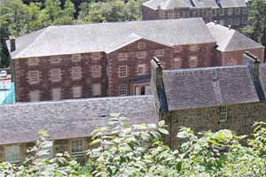 New Lanark Heritage Site and Museum NS 882 424
The New Lanark cotton mills were founded in 1786 by David Dale in a partnership with Richard Arkwright. The mills used the recently developed water-powered cotton spinning machinery invented by Arkwright. Dale sold the mills, lands and village in the early 19th century to a partnership that included his son-in-law Robert Owen. Owen, who became mill manager in 1800, was an industrialist who carried on his father-in-law's philanthropic approach to industrial working and who subsequently became an influential social reformer. New Lanark, with its social and welfare programmes, epitomised his Utopian Socialism. The town and mills are important historically through their connection with Owen's ideas, but also because of their role in the developing industrial revolution in the UK.
The New Lanark mills depended upon water power. A dam was constructed on the Clyde above New Lanark and water was drawn off the river to power the mill machinery. The water first travelled through a tunnel, then through an open channel called the lade. It then went to a number of water wheels in each mill building. It was not until 1929 that the last waterwheel was replaced by a water turbine. Water power is still used in New Lanark to provide electricity for the tourist areas of the village.
In Owen's time some 2,500 people lived at New Lanark. Owen found the generally prevailing conditions of work
unsatisfactory and resolved to improve the workers' lot. He paid particular attention to the needs of the 500 or so children
living in the village and working at the mills, and opened the first infants' school in Britain in 1817.
New Lanark became celebrated throughout Europe, with many statesmen, reformers and royalty visiting the mills. They were astonished to find a clean, healthy industrial environment with a content, vibrant workforce and a prosperous, viable business venture all rolled into one. Owen's philosophy was contrary to contemporary thinking, but he was able to demonstrate that it was not necessary for an industrial enterprise to treat its workers badly to be profitable. Owen was able to show visitors the village's excellent housing and amenities, and the accounts showing the profitability of the mills.
As well as the mills' connections with reform, socialism and welfare, they are also representative of the industrial revolution that occurred in Britain in the 18th and 19th centuries and which fundamentally altered the shape of the world. The planning of employment in the mills alongside housing for the workers and services such as a school also makes the settlement iconic in the development of urban planning
After the mills closed there was a large migration away from the village, and the buildings began to deteriorate. The top two floors of Mill Number 1 were removed in 1945 but the building has since been restored and is now the New Lanark Mill Hotel. In 1963 the New Lanark Association (NLA) was formed and restoration of other buildings commenced. In 1974 the New Lanark Trust was founded to prevent demolition of the village.
The site is now controlled by the NLT, either directly or indirectly. Most of the buildings have been restored and the village is now a major international tourist attraction.
Section 9
-
Kentigern Lanark Loop
From the entrance gateway to the Visitor Centre walk a little in the upstream direction and take the road
on the topside of the Counting House, Caithness Row, and follow for a short distance to its end. A path leads
uphill from here which is later signed as The Beeches. Follow this path all the way until it reaches the Main
A73 and turn left. After a short distance the entrance gate of a graveyard is encountered. Continue to a second
gate and enter. Once inside the graveyard keep heading generally rightwards finally to encounter the ruins of the
Kentigern Church.
From the back of the Kentigern Church exit by a path through a pair of small pillars back to the Main Road and follow
the signs to the Town Centre. Continue all the way down the Main Street to the Town House with its statue of William Wallace.
Cross the Wellgate and take Castlebank Street on the left past Lidl and across from a small car park go Left into Castle Park,
once the site of Lanark Castle (of which nothing remains). Follow the paths rightwards keeping to the topside of the park
eventually to exit onto St Patrick's Road where you re-join the Clyde Walkway.
-
Lanark Museum NS 880 440
The Royal Burgh of Lanark Museum houses a collection of items which illustrate the ancient and varied
history of the town. Lanark is one of Scotland's oldest burghs, and from the time of King William the Lion was a
favoured hunting area of the Kings of Scotland. It also has associations with two of Scotland's greatest heroes:
William Wallace and King Robert the Bruce.
-
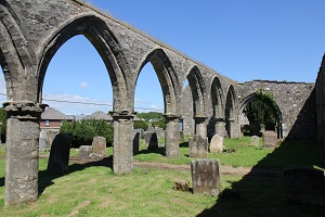 Kentigern Church NS 890 431
Remarkably there is only one medieval church in Scotland dedicated to St Kentigern under his own name. There are many others dedicated to him under the name of St Mungo. The church of St Kentigern lies immediately to the south-east of Lanark and its position outside the main medieval town is an indication of its antiquity. Tradition tells that it was founded by the Saint himself, shortly before he died in 603 AD.
Between the years 1150 and 1153 King David I granted the church of St Kentigern's, with all the lands,
belonging to it to the Monastery of Dryburgh. The grant was confirmed by Bishop Herbert of Glasgow, by Malcolm IV and
William the Lion. The rights of the church to the Monastery of Dryburgh which was confirmed by various bishops, popes,
and kings from 1174 to 1258. In 1228, Pope Gregory VIII took the parish church of St Kentigern's and the other
possessions of the Abbey of Dryburgh under his special protection, "lest they should be disturbed by the injuries of
wicked men".
William Wallace is reputed to have met his wife Marion Braidfute in St Kentigern's Church. Wallace was
involved in a skirmish with English soldiers garrisoned in Lanark and fled the scene. Edward 1's sheriff executed Marion
instead of her husband and Wallace took his revenge by killing the sheriff, setting himself on the path of rebellion and achieving iconic status as the hero of the Wars of Independence.
-
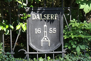 Dalserf Church NS 79980 50712
There is ample evidence that the Clyde Valley has been settled from the earliest times and there is no more likely spot than the holm of Clyde, where the present village and Church of Dalserf stand. Such a place, sheltered and protected by the river on three of its sides, and one of the most fertile tracts of ground in the Parish is typical of the sites of many early settlements.
Not long after the departure of the Romans there appeared in South Scotland small groups of men who were to sow the seeds of Christianity among us. It is not without good reason that this part has been called the "Cradle of Christianity" in Scotland, for it was here that St.Ninian and his disciples were first to preach the Word, here that St.Patrick was born, and here that St.Kentigern, or Mungo as he is often called, founded his churches. Associated with the above were St.Serf and St.Machan, the two with whom we are concerned.
There is some considerable doubt about the life history of St.Serf. One of the most popular stories suggests that
he was the teacher and counsellor of St. Mungo, who is said to have been brought up by him. He spent a great part of his
life at Culross in Fife, but he is also known to have worked in the Clyde Valley. A possible meaning of the word Dalserf
is "the field of Serf", indicating a definite connection of the Saint with our district.
St.Machan's history, on the other hand, is better known. When Cadoc left Scotland to return to Wales about the middle of the sixth century, he left behind him an earnest worker in Machan, who had been trained in Ireland but then devoted the rest of his life to the further evangelisation of the Clyde Valley. One of his centres, and perhaps the main one, was Dalserf, which was formerly known as Machanshire, and still contains in its place names many references to the Saint.
It is probably reasonable to assume that the present site of the Church supported a much earlier religious edifice which might even have been Serf's or Machan's earliest chapel.
Since these early times the story of Dalserf has been intimately entwined with that of Scotland. William Wallace had connections with the Parish. Legend has it that he spent some time in hiding within its bounds. After the notorious skirmish in Lanark, and the subsequent murder of the English Governor Haselrig, he spent time in hiding in Clydeside and it was just across the Clyde, at the Abbey of Mauldslie, that he was made Guardian of Scotland.
The name of Dalserf appears throughout the Wars of Independence, the turbulent times of Mary Queen of Scots and
the dreadful "Killing times" of the Covenanting Wars. The full story of Dalserf is much too long and varied to be recounted in this brief passage.
-
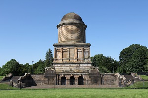 Dukes of Hamilton Mausoleum NS 726 561
Built as both a family chapel and final resting place for the 10th Duke of Hamilton, construction of the
mausoleum commenced in 1842 and was completed, some 16 years later, in 1858. The structure rises to a height of 120
feet and cost in excess of 130 pounds.
An expert in Egyptian culture, the Duke sourced artefacts for the British Museums Egyptian collections. It is
therefore, of no surprise that such a man should have chosen to be interred in the sarcophagus of an Egyptian
princess, which rested on a marble plinth within the chapel of the mausoleum (now relocated).
The remains of the 10th Duke of Hamilton and his accompanying family members (who occupied the crypt below)
were reinterred in 1921 when concerns were raised over the structural stability of the mausoleum. Though now
structurally stable the mausoleum is recorded to have subsided by 18 feet.
-
Low Parks Museum NS 723 558
Low Parks Museum in Hamilton is a 4-star Visit Scotland attraction situated in part of the Duke of
Hamilton's former estate. Three historic buildings survive - Portland, built in 1696 for David Crawford, secretary
to the 3rd Duke and Duchess of Hamilton, Hamilton Palace Riding School, built in 1837 by Alexander, 10th Duke of Hamilton.
The family friendly museum traces South Lanarkshire's history: early settlement and archaeology; Hamilton Palace
and South Lanarkshire's Royal Burghs; working life; design, industry, technology and agriculture. The Cameronians
(Scottish Rifles) Gallery reflects over 300 years of service around the world, from the Covenanting roots in the
17th century right up until disbandment in 1968 and beyond.
-
Strathclyde Country Park and Roman baths NS 732 577
It is reckoned that a Roman Road linked the major fort at Castledykes near Lanark via Wishaw and Motherwell to a fort at Bothwellhaugh - now located in the Strathclyde Country Park. This was most probably a supply fort for the Antonine wall. All that remains of the fort are the foundations of a bath house which was discovered when the Clyde was rerouted to form the Park. The presence of a bath house indicates that the fort was occupied by a high ranking officer but little is known about the fort to support this supposition. Excavations indicate it was large enough for a cohors quingenaria equitata, a mixed unit of infantry and cavalry of about five-hundred horse and foot soldiers. The bath house has been reconstructed and an interpretation board has been installed giving details of its use. There is a persistent tradition of a Roman road crossing the Clyde at Bothwell Bridge on the line of its medieval successor and might even form part of a cross route extending beyond Bothwell.
Section 10
-
 Site of battle of Bothwell Bridge NS 710 577
Following the Restoration of Charles II, the Presbyterians in Scotland were obliged to adopt the Episcopalian form of worship and were increasingly persecuted for their beliefs. This broke the terms of the National Covenant and hard-line Covenanters continued their Protestant form of worship at prescribed outdoor meetings, known as conventicles. These were often broken up by squads of government dragoons , including those led by John Graham of Claverhouse On 1 June 1679, Claverhouse had encountered such a gathering at Drumclog, but his troops were routed by armed Covenanters and he was forced to flee to Glasgow. Following this initial success the Covenanters spent the next few weeks building their strength, as did the government. Charles' son, James Duke of Monmouth was sent north to take command, and the militia were raised.
The Covenanters established a camp on the south bank of the Clyde, north of Hamilton. They numbered around 6000 men, but were poorly disciplined and deeply divided by religious disagreements. They had few competent commanders and were riven with internal doctrinal disputess. The government army numbered around 5000 regular troops and militia, and was commanded by Monmouth, supported by Claverhouse and the Earl of Linlithgow. The royalist troops were massed on the northern or Bothwell side of the river Clyde on sloping ground that included a field that has since become known as the Covenanters Field.
The battle centred on the narrow bridge across the Clyde, the passage of which Monmouth was required to force in order to come at the Covenanters. David Hackston led the defence of the bridge for the Covenanters and had some initial success in the initial skirmishes at the bridge itself. But his men were badly supported, lacked artillery and ammunition, and were forced to withdraw. Once Monmouth's men were across the bridge, the Covenanters were quickly routed. Many fled into the parks of nearby Hamilton Palace, seat of Duchess Anne, who was sympathetic to the Presbyterian cause, and it was in this area that the final engagements took place. The numbers of covenanters who were killed varies widely with estimates ranging from 7 - 700 according to the Scottish Battles Gazetteer. Around 1200 were taken prisoner and were taken to Edinburgh where they were held on land beside Greyfriars Kirkyard in an area now known as the Covenanters' Prison.
-
 Bothwell Church NS 705 56
Christianity was introduced to the people inhabiting the fertile valley of the river Clyde at a very early time.
And, probably, one of the earliest settlements was at Bothwell – in the centre of the valley, at the ford of the river and easily accessible from all directions. Some believe it was the site of Druid worship before it became the site of a Christian community.
By the end of the first century, the busy trade route from Carlisle to Dumbarton ran along the hillside to the east and north of Bothwell. Roman legions had encamped close to where the present church stands. As in the days of St Paul, so for long afterwards, Christianity travelled along the Roman roads. Having come from Gaul, it is quite possible that these soldiers were the first to bring news of Christianity to the peasants living along the river Clyde in this part of Scotland.
In 587 AD Columba crossed from Iona to the mainland and travelled south. Meeting with Kentigern (St Mungo)
at what is now Glasgow, Columba encouraged Kentigern to continue evangelising southwards. When Kentigern
began his journey, he arrived at a crossing over the river Clyde around which peasants farmed and fished.
Here Kentigern stayed for some time, building a shrine, no doubt of wattle and turf, and giving locus to
the worship of the fledgling Christian community. Remaining with him was one of Columba's followers, named,
Baithene (Bothan). (Could he, possibly, be the source of the name, Bothwell? )
In the mid-12th Century King David 1 created and granted the Barony of Bothwell to David Olifard. He
built a motte and bailey stronghold near the site of the present church and probably beside the original
religious settlement. In the 13th century the Lordship of Bothwell passed by marriage to Walter de Moravia
(Moray) and he set about constructing a much grander castle to reflect his status. After Bannockburn the
Lordship pf Bothwell passed into the hands of the Douglass family and Archibald Douglas ‘Archibald
the Grim’ had a collegiate church built on the site of the pre-existing church.
The relationship between the church at Bothwell and the cathedral of Glasgow was strengthened following
the death of Archibald, Earl of Douglas (benefactor of the church). So that prayers may be said – as at
Bothwell – for the safety of his soul, and that of his family and successors, his widow pledged to
the cathedral the gift of three stones of wax yearly for the improvement of worship and to supplement the
lighting. This annual gift was made upon the feast of Pentecost. Sadly, after some years, the benevolence
defaulted. It was resurrected in more modern times however when, come Pentecost, the congregation of
Bothwell gifted flowers for the adornment of Kentigern's tomb which lies in the cathedral crypt.
Later improvements to the church added the present Nave and subsequently linked this with the existing
Quire by means of a bell tower to form the fine building which you see today.
-
 David Livingstone Centre NS 695 585
The David Livingstone Birthplace Museum is a biographical museum dedicated to the life and work of
the explorer and missionary David Livingstone. It is sited in the grounds of the David Livingstone Birthplace,
which contains historic grounds as well as the museum. The museum itself is housed in Shuttle Row, the building
where David Livingstone lived and where he was born on 19 March 1813.The former textile mill buildings once housed
24 families including Livingstone's.
The Collection at the David Livingstone Birthplace Museum contains a diverse range of material exploring the
life, work and legacy of David Livingstone (including his family and associates) and the history of Blantyre Mills
and Village. The centre depicts Livingstone's life from his early childhood working in the mill, to his travels
throughout Southern Africa.
Livingstone had a mythic status that operated on a number of levels; Protestant missionary martyr, working-class
"rags-to-riches" story, scientific investigator and explorer, imperial reformer, anti-slavery crusader, and advocate
of British commercial and colonial expansion.
His fame as an explorer and his obsession with learning the sources of the Nile River was founded on his desire
to solve that age-old mystery. His subsequent exploration of the central African watershed was the culmination of
the colonial penetration of Africa. His missionary travels, "disappearance", and eventual death in Africa gave
rise to subsequent glorification as a posthumous national hero.
-
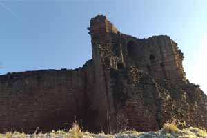 Bothwell Castle NS 6886 5929
Bothwell is one of the most attractive of the grand Scottish castles. It is in a fabulous location on a bend in the River Clyde where a fairly deep gorge has been cut. The oldest parts of the castle are built of beautiful deep red sandstone and the masonry work is breath-taking.
The castle stands at a strategic location - the main crossing point of the Clyde for any invaders coming from the south. As such it has played a major part in the wars between England and Scotland and both sides gained and lost possession of the castle many times.
The castle was originally built by Walter of Moray or, quite likely, his son William in the thirteenth Century. Many of the finest masons from continental Europe were brought in. The quality of the work of the master masons is still there to see in the beautifully dressed mouldings around windows and doorways and arches in the old tower.
However, work stopped long before the castle was finished. Maybe money ran out. Maybe the wars with Edward I of England got in the way. Most likely both of these were factors.
In 1296 Edward I took the castle. In 1298 the Scots laid siege for over a year before finally retaking it. Edward was back again in 1301 with innovative new siege engines and the castle changed hands once more. The English held on to it until the Battle of Bannockburn in 1314. After the battle a number of the English lords took shelter here, but the constable of the castle surrendered the fortress and it was once more in the hands of the Scots. Twenty-two years later, Edward III invaded from England, captured Bothwell Castle and made it his invasion headquarters. But just a few months later Sir Andrew, a descendant of Walter of Moray, retook the castle. Robert Bruce's policy was to destroy castles that the English could use to control the Scots and Andrew pulled down much of the donjon tower.
The Black Douglass's took possession of the castle when Archibald ‘The Grim’ married Joanna
of Bothwell in 1362. In the late 1300s and early 1400s the Douglass's repaired and extended the buildings and their work forms a substantial part of what stands today.
-
 Glasgow Green Peoples' Palace Museum NS 600 6425
The People's Palace and Winter Gardens is a museum and glasshouse situated in Glasgow Green,
In earlier times, the East End of Glasgow was one of the unhealthiest and overcrowded parts of the city and the
People's Palace was constructed to provide a cultural centre for the people.
Since the 1940s, it has been the museum of social history for the city of Glasgow, and tells the story of the
people and the city from 1750 to the present day. The collections and displays reflect the changing face of the city
and the different experiences of Glaswegians at home, work and leisure. Current displays include glimpses of typical
Glasgow history such as life in a "single end" (a one-room tenement home), going to "The Steamie" (the communal
laundry), nights out at "The Dancing" in the famous Barrowland Ballroom and trips "Doon The Watter" (down the Firth
of Clyde) on steamers such as the Waverley.
-
Trongate (St Thenew's Gait) NS 598 653
This street ran roughly from east to west, from the Saltmarket in the east to the chapel and cemetery of St Teneu
in the west, a little to the north of where St Enoch's Church stood in the nineteenth century. It followed the
course of what is now the Trongate and Argyle Street. The grid reference given is for a point near the western
end of the street, closest to St Enoch's Church. In 1495 a charter of Martin Wan, chancellor of the Cathedral,
records the lands of St Thenew's Chaplain ('terras capellani Sancte Tanew') lying on this street.
-
Provand's Lordship NS 601 655 (just to the west of the cathedral)
Provand's Lordship was built as part of St Nicholas's Hospital by Andrew Muirhead, Bishop of Glasgow
in 1471. A western extension, designed by William Bryson, was completed in 1670. In the early 19th century
the house was occupied by a canon supported by income from the Lord of the Prebend (or "Provand") of
Barlanark – hence the name.
One of only four surviving medieval buildings in Glasgow, it is now a museum and is furnished with a
fine selection of 17th century historic furniture and royal portraits.
-
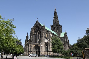 Glasgow Cathedral NS 603 656
The Cathedral's origins date back to about AD 550 when St Mungo, also known as St Kentigern, founded a religious community here around a small church. Today this original church is the site of the Blacader Aisle in the Lower Church of the cathedral, the structure that extends beyond the very short South Transept.
During Kentigern's time the church was visited by St Columba. After his death on 13 January 614, St Kentigern was buried close to his church. His tomb today lies in the centre of the Lower Choir, probably on the actual site of his grave.
St Kentigern's original church was built of wood, and was probably changed and enlarged over the following five centuries. The first stone church on the site was consecrated in the presence of King David I in 1136 and occupied the area now covered by the nave, with part of the earlier church probably surviving off to one side. This first stone church was destroyed or badly damaged by fire within a very short time, and its replacement was consecrated in 1197 by Bishop Jocelin.
The earliest significant parts of what you can see today are the walls of the nave, up to the level of the bottoms of the windows. These date back to the next round of rebuilding, in the early 1200s. In the mid-1200s much of the rest of the cathedral appeared: in particular the upper and lower choirs were added to the east end of the nave.
In the 1400s a tower was built above the crossing, and two more at the western corners of the nave. At the same time the Blacader Aisle was built on the site of St Mungo's original church and the chapter house was added at the north east corner of the choir.
In the 1800s major repairs included the removal of the two western towers leaving the cathedral much as you see it today.
Today's visitor to Glasgow Cathedral finds an awe inspiring place. It is overlooked from the east by the Glasgow Necropolis and has a fine precinct created by the building in 1993 of the St Mungo Museum, which doubles as a Cathedral Visitor Centre.
The site on which the cathedral was built slopes down from west to east. This allowed the building of its most unique
feature, a lower church effectively occupying the whole of the area under the choir. This is a beautifully vaulted space.
At its heart lies the tomb of St Kentigern or St Mungo, while at its east end are a series of chapels.
These include the Chapel of St John the Evangelist, still containing part of what is believed to be the well, used by
St Kentigern in the late 500s. These chapels were particularly well used after 1451, when the Pope declared that
a pilgrimage to Glasgow Cathedral would carry the same merit as one to Rome. In the same year he approved the
foundation of the University of Glasgow.
|